Late last night, I pulled in to Doug and Barb's after finishing my first solo backpack of the trip, in North Cascades National Park. It's nearly two and I don't see myself getting out of my pajamas today.
I chose a shorter total hike, given the length and logistics of travel to and from the park. The trailhead was up the valley from the village of
Stehekin, at the northern end of
Lake Chelan, itself a good 4-hour drive from Olympia. The only access to the village is by ferry, which leaves only once a day, at 8:00 a.m. I left a day early, driving through Seattle and over Stevens Pass to a state park not far from Chelan, where I car-camped and got up at a relatively reasonable hour (5:00 a.m.) to make the boat. After the ferry was a shuttle to the end of the valley, and only
then did I start the hike for real.
Wenatchee State Park was your typical RV campground, but on a striking river-fed lake. After dinner, I took a walk along the river, spotting a family of ospreys hanging out in the treetops. At a bridge, I saw the man-made platform where they nested, and was promptly dive-bombed by a protective parent.
 |
| This was later. I was too busy getting out of there to take pictures at the time. |
|
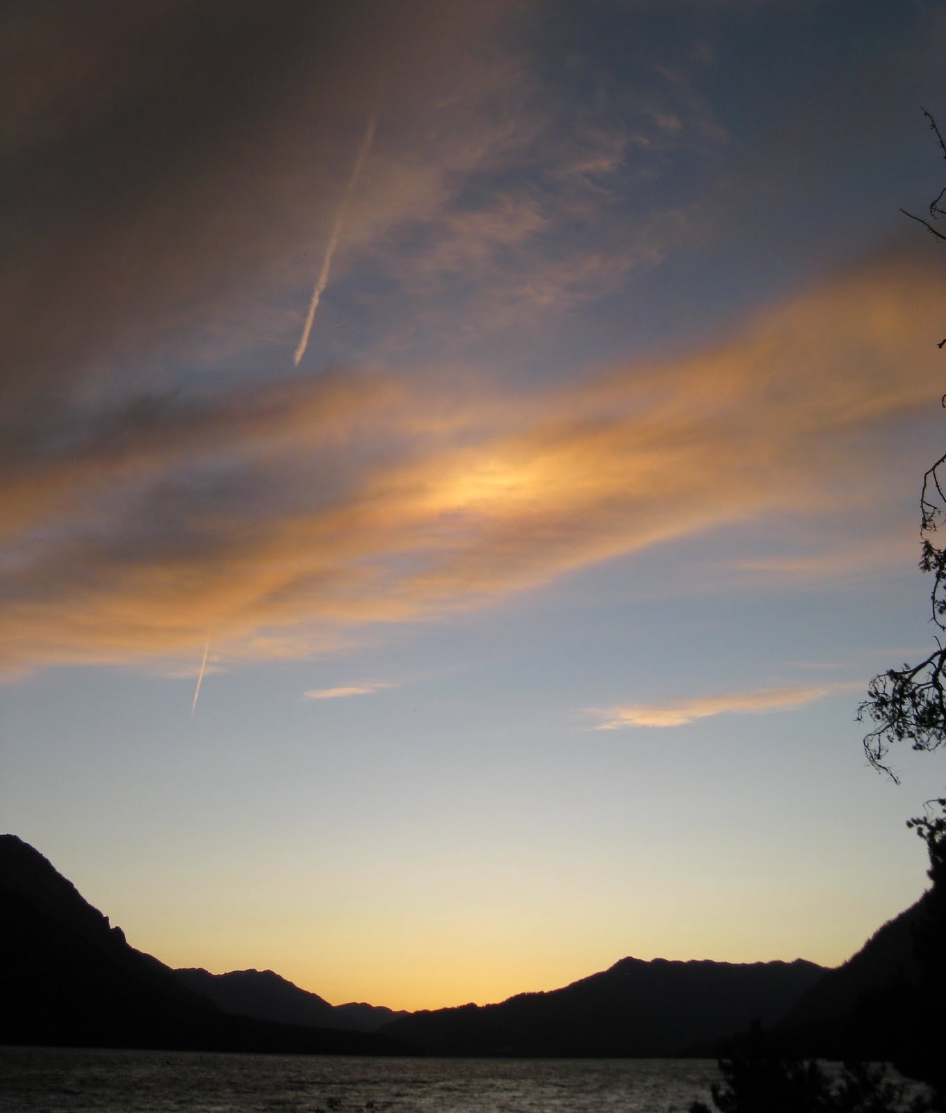
Then I watched a spectacular sunset over the lake. That strange bright spot in the second photo isn't a photography error; the optical effect persisted for many minutes after the sun dropped over the horizon. It started out distinctly purple.
The next morning was bright and glorious; the drive was nearly as scenic as the hike. After passing over the first crest of the Cascades, you switch from wet, coastal eastern Washington to dry, high, western Washington. The hills were scrub-grassy and nearly treeless except for acres and acres of commercial apple orchards (heavily irrigated). They abruptly drop off into dam-held lakes strung along freight tracks and highway. It felt very
western; unfortunately, I didn't stop the drive to get photos. Here is Google Images' impression of the place:
The four-hour ferry ride was way long. I realized well into it that I should have sprung the extra $$ for the fast ferry, but once I got on the trail, I forgot about it. Until the return trip.
The ferry lands you in Stehekin, which like a lot of tourist-dependent destinations is both obviously beautiful and subtly appalling. At the ferry landing, there is exactly one general store, one restaurant, one gift shop, and the National Park visitor center. Up the road is a bakery/cafe and an organic farm that sells fresh fruits and vegetables, and the rest is nothing but scattered homesteads heading up the valley.
 |
| The organic farm; the fruit was amazing. |
Everything was absolutely lovely, and it's the friendliest place I've been yet, even counting the almost obligatory friendliness Dad, Doug, and I experienced on Lopez Island in the San Juans. I hefted my pack up the road to stop at the bakery, once when headed in to hike, and once coming out, and
both times I got offered a ride by total strangers, women with infants no less.
 |
| Okay, but which one of you is the serial killer? |
 |
| And seriously, this is what every resident looked like: Old truck, old dog, chill dude. |
You're almost tempted to buy some land and build yourself a little cabin. But then you think what it must be like to order bananas via floatplane and spend seven months a year seeing no one except the 74 other residents. If you need a new washing machine, you wait for it to come by barge. All I can figure is, if you want to live in Stehekin, you'd better a) like yourself and/or your family real well and b) know how to fix things.
After grabbing an ice cream at the bakery, I rode the adorable NPS shuttle bus to the end of the Stehekin Valley Road.
 |
| THIS GOT HERE BY BARGE. |
The Stehekin Valley Road continues about 11 miles past the bus drop-off. Washouts have made the road impassable to vehicles; my guidebook lists it as a hiking trail. But when I picked up my wilderness permit, the ranger said that parts of road were a tough pass for hikers, too. She advised that I take a parallel trail, and to camp farther down the valley on my final night, since the campground I'd hoped for was cut off. Both of these details became important, one sooner, the other later.
The old road made for a blissfully easy walk to my first night's camp. It was flat, wide, and clear.
When I reached the point where the old road and the parallel trail split, I had to second-guess the ranger. The road looked great, while the trail was small, brushy, and went up a hill. And she hadn't said it was
impossible, just
difficult. So I took the road. The first washout was a piece of cake, if a bit damp; the road had become overrun by a pretty little waterfall you had to walk under. But the second washout was truly impassable. The river had left nothing but a cliff above the water; if I hadn't had 40 lbs on my back, I probably could have edged along a ledge, but as it was, I was forced to backtrack about a mile and take the bypass trail.
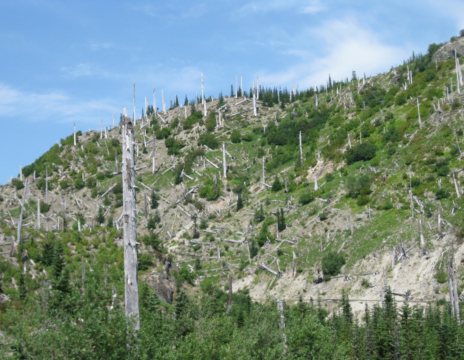
 |
| It passed through an old burn, which was hauntingly beautiful. |
 |
| I think this might be fireweed, but my identification is based entirely on circumstantial evidence. |
In the middle of the trail, I came upon a black bear crossing the road. I did the shout-and-clap thing and waited for him to crash away through the woods. No time for pictures of that one.
Because the campgrounds are situated along an old road and were originally intended for car camping, they were pretty luxurious, with picnic tables, fire pits, and easy-to-use bear-proof food boxes.
 |
| My breakfast preparations |
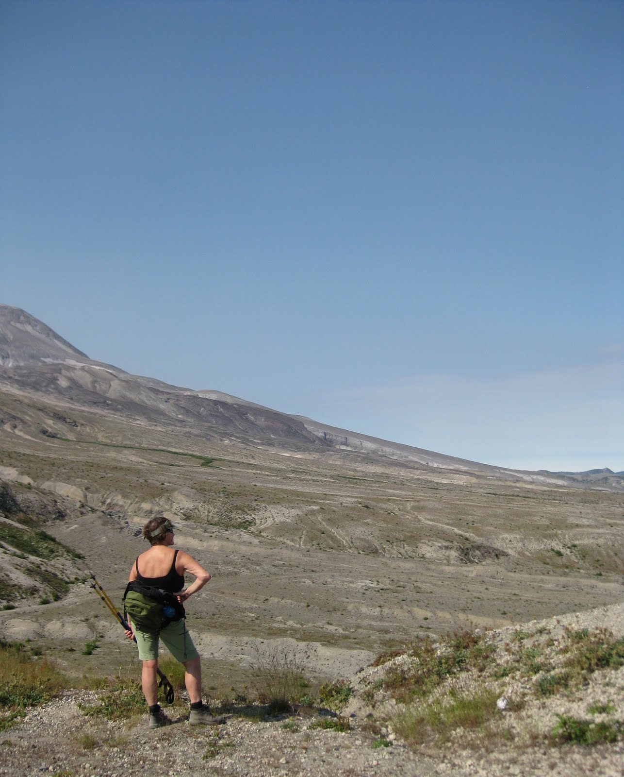
The next day, I hiked to the end of the road and beyond, to a campsite the ranger told me was also partially washed out. She wasn't sure if the bear box and privy were still there. My map showed the campground just south of where the trail crossed the creek. When I got there, there was no bear box or privy, just a couple of washouts and an old sign, broken and pointing to nothing. I walked as far as the creek and didn't see an obvious camp. Luckily, there was a very pretty gravel bar with some obvious tent sites. I pitched my tent, hung my food, and went out for a day hike to Cascade Pass.
About a quarter mile north of the creek, I found the brand-new, rebuilt camp. Oh well; my spot was nicer.
 |
| At the very least, my illegal campsite was inconspicuous. |
 |
| The river near camp |
 |
| A view of Horseshoe Basin from my river camp |
The rest of the afternoon, I hiked to Cascade Pass. It was gorgeous; there were views and waterfalls everywhere. My photography doesn't do it justice. I'd thought about continuing up a strenuous spur trail to the foot of a glacier, but when I got to the pass, the view was so nice that I figured 11.6 miles was enough for one day.
 |
| Looking west on the way up |
 |
| Looking east from the pass. The eastern approach was an easy day hike with road access, so the top was relatively crowded. |
 |
| One of the innumerable waterfalls |
 |
| A different waterfall, this one on the trail |
 |
| I think this is Yawning Glacier; it's not the one I skipped out on, just another part of the view. |
 |
| A last few snow bridges forming caves over yet another waterfall |
 |
| Reddish algae forming "watermelon snow" in the highlands. |
The next morning, I took another day hike into Horseshoe Basin. The trail was very brushy and very wet.
 |
| Trail. Not sure if you can see from this photo, but IT IS A STREAM. |
Unfortunately, I'd left my gaiters behind, and my ankles were taking a thwacking. Then I remembered that I'd given in and bought those ubiquitous convertible hiking pants, the ones with the zip-away legs. The kind I bought zip away to capris instead of shorts, meaning I had pant legs that were just the right length--they even had a draw-string ankle, which turned upside-down made them perfect gaiters. They worked awesome, even though they made my toe shoes look especially gorilla-ish and weird.
Horseshoe Basin was completely worth it. It's a spectacular natural amphitheater curtained with over a dozen waterfalls on all sides. Not that I would have been able to capture it, but my camera chose a particularly inopportune moment for the autofocus to go on the fritz.
 |
| I'm saying, "What the...? Come on!" |
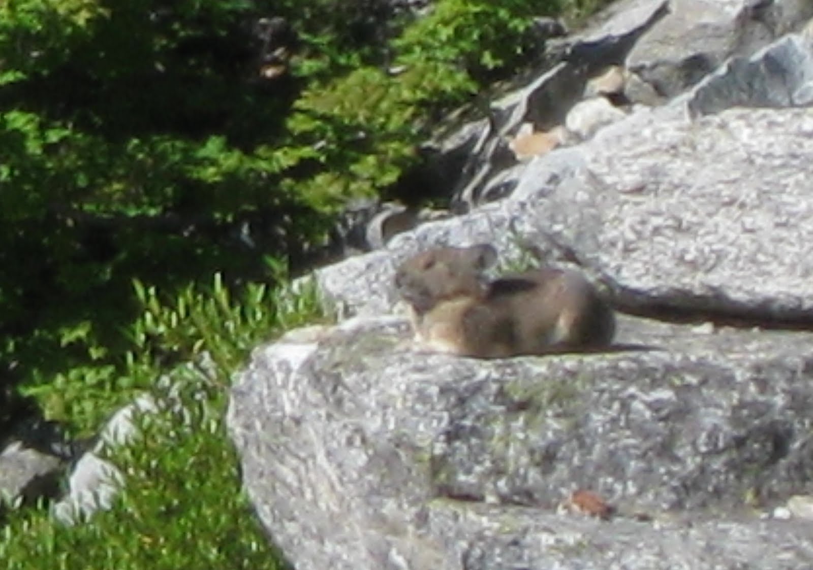
I got this okay shot of a pika, or
alpinus hamster adoribilus. I missed a shot of the fox-colored weasel that obviously survives by devouring the cute little things; he was in plain sight, but he moved too fast.
 |
| When they spot you, they say, "EEP!" and run away. |
I returned to camp and packed up for the hike back down the valley. When the ranger switched my camps, I'd thought, "What's a few more miles? And I'll be that much closer to the ferry." I'd never done the math to figure out that with a morning hike to Horseshoe Basin, I'd set myself up for a grueling 16.4-mile day.
I booked it for the first part, hoping to make a mid-point campground before stopping for lunch. I was so exhausted and eager to get to the campground that when I heard a cracking sound through the trees, I hopefully assumed it was hikers breaking up firewood. I didn't realize it was a bear just off the trail until I was almost past it. He was neck-deep in some rotten stump and hadn't noticed me so far, so I kept my eye on him and snuck by. He never even looked up. I'm not sure if it was a different bear or the same one as the previous day; it was in nearly the same place. Again, over too fast to take pictures.
By the time I got to actual camp, the sun was slipping behind the mountains, and I was crawling. It was hot and sunny all trip, and I was down to a sportsbra and shorts (and pack, of course), which left me lunch for swarms of biting flies that came out in the heat. I was sore and itchy and dusty and exhausted.
 |
| Hiker's tan. NOTE: THAT IS NOT A TAN. IT IS DIRT AND SCABS. |
Luckily, the camp was a lovely spot by the green glacial river, and like the other roadside campgrounds, it was spacious and private, with my very own bear box and a privy with a whole soap dispenser of hand sanitizer. Backpacking makes you appreciate stuff in a whole new way.
 |
| Another aqua-green glacial river |
 |
| I'm normally not big on fires when I'm alone, but it's undeniably comforting after a too-long day. |
The next day was a breeze; I woke up in plenty of time to go less than a mile to the shuttle pick-up. There, I hung out with a bunch of other returning backpackers. Time on the trail makes people very social. You're hungry for new company, and you all have common stories to share. The most interesting people were an Australian couple who were 80 miles away from completing the Pacific Crest Trail, a western version of the Appalachian Trail that stretches from Mexico all the way to Canada. They were hoping to finish it off in the next three days.
Yeah, do that math; they were going to cover 80 miles in 3 days, and the day I met them was half taken up by a shuttle trip in and out of Stehekin to grab supplies. The guy, who had grown an unbelievable face thicket after starting clean-shaven in Mexico, said they got between 35 and 40 miles on a good day. As badass as that is, and as wimpy as it made me feel for suffering after "just" sixteen and a half miles, I later decided to appreciate the relative luxury of a slower pace. After all, it allowed me this:
 |
| I was going to take a picture before I ate half of it, but I blinked and it was gone. |
The ferry ride back was really long, with our only entertainment being jet skis that swarm the big boat like mosquitoes, driving to catch air off the wake. The drive back started beautifully, with an incredible trip through canyons smoked out by wildfires. But approaching Seattle, there was interminable traffic of everyone coming down off a weekend in the mountains, and I got back at just about midnight.
Next, I eagerly await the title and plates to my Subaru; that will be my final ticket to Glacier and the Mountain West.